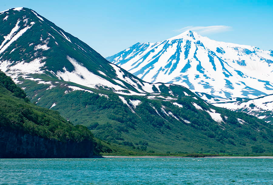
Russkaya Bay can be recognised as a separate ecosystem, where various species of marine creatures meet and peacefully coexist. These include whales, killer whales, sea birds, sea lions, as well as killer whales meeting tourists on the shore.
One of the most picturesque bays in Kamchatka, where you can meet the dawn on the shore and bathe in hot springs 10 km from the coast.
Best Kamchatka places
Popular tour
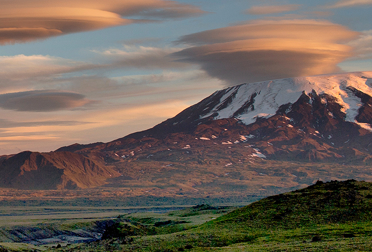
A reserved lake surrounded by the volcanoes of the North
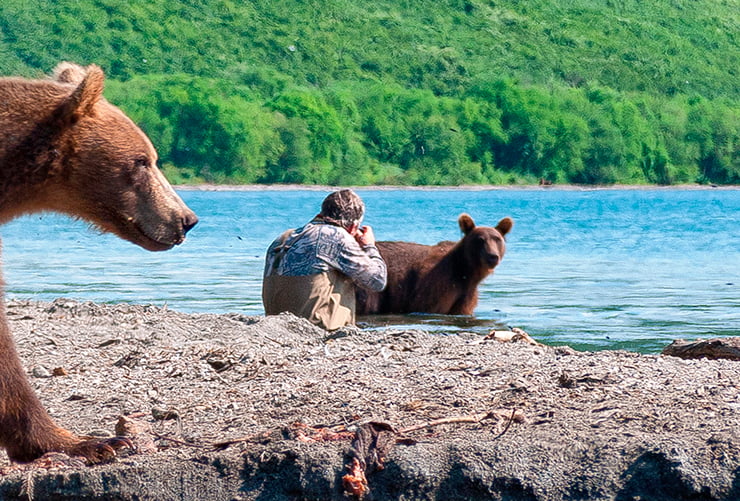
We are going to the north of Kamchatka to the area of Kliuchevskaya group. We will look for bears in the area of Lake Azhabachye and climb an active volcano
If you haven`t found a suitable tour in the general catalog, please send us your preferences and parameters for your future trip— dates, number of people. Our manager will be sure to make you a good offer.
Anastasia
Bays and coves of Kamchatka
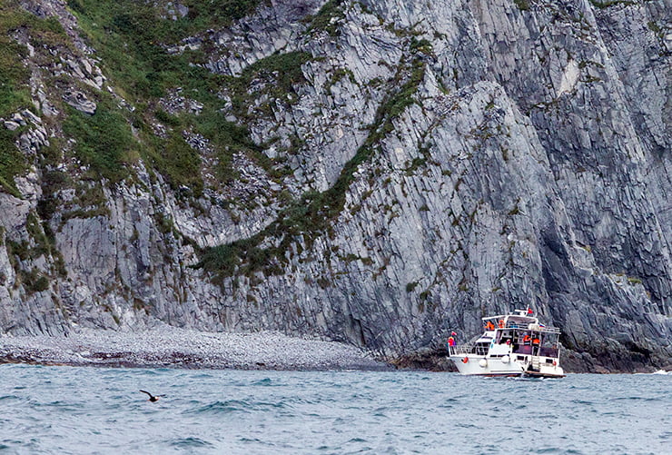
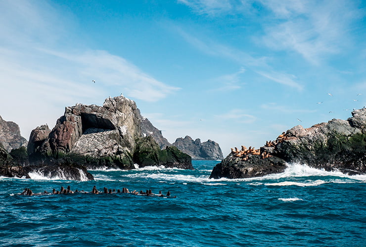
Kamchatka, being a peninsula, is washed by sea waters on both sides - east and west. This geographical peculiarity has favoured the emergence of many bays here. They look very beautiful, and each has its own peculiarities. In the northern part of the peninsula the coastline is characterised by tundra vegetation; to the south there are typical Kamchatka forests. On the shore one can see animals living here, especially pinnipeds, and bird bazaars in many places are a characteristic feature of the landscape.
The largest number of bays is located on the eastern coast and is connected with Avacha Bay. Mountain ranges reach here, spectacularly plunging over the ocean water, forming steep rocky shores. The union of water and stone over many centuries has created landscapes of striking beauty. The Pacific Ocean is rich in a variety of wildlife, so despite the more than chilly water, diving enthusiasts like to dive from the east coast. The western side of the peninsula faces the Sea of Okhotsk with gentle shores. The landscape here is predominantly tundra, harsh. The rivers have created estuaries in this area.
Krasheninnikov Bay
The bay was named in honour of the Kamchatka explorer Stepan Petrovich Krasheninnikov, who reached these places in the middle of the 18th century. He named the small water area he found Tarjinskaya (after the extinct volcano Tarja located on the shore), and under this name the bay appeared on maps until it was renamed. It is located between the peninsula of the same name and the mainland and is sufficiently deep - more than 20 metres. The open part faces north.
In administrative terms, b. Krasheninnikova belongs to the Yelizovsky district. Krasheninnikov Bay belongs to the Yelizovsky District. The closed town of Vilyuchinsk, officially established in 1968, is located on the coast. Before that time there was a settlement here in Krasheninnikov's time, which he called ‘Tarein ostrozhek’. During the Soviet period, a submarine base of the Pacific Fleet was formed here, which still exists today.
On the shore of the bay there is a grave of British Navy Rear Admiral David Price, who died in these parts in the mid-19th century, when the British made a military raid on Kamchatka. A lighthouse was built on Khlebalkin Island, which belongs to Krasheninnikov's water area.
Tikhayai
Tikhaya Bay fully justifies its name and is one of the popular tourist spots in Kamchatka. Located not far from Petropavlovsk-Kamchatsky in the waters of Avacha Bay, it is not distinguished by its large size. But its rocky surroundings are very picturesque, and the beach is sandy. The bay is famous for its fishing. Tourists arriving here by boat can catch halibut, perch, flounder, cod and other types of fish.
Bechevinskaya and Finval
In the same Yelizovsky District, on the northern side, in the water area of Avacha Bay, there is another bay - Bechevinskaya Bay. Its depth is more than twice as deep as Krasheninnikov Bay. For the first time researchers reached it in the middle of the XVIII century. T.I. Shmalev called it the harbour of the Holy Archistratigus Gabriel, giving it the name of the ship with which he arrived in these parts. Under this name he marked it on the map. However, later the bay was renamed in honour of I. Becevin - a merchant, financier and financier. Bachevin, a merchant who financed and organised the expedition to Alaska.
In the 19th century, the bay was periodically explored and mapped by Russian military sailors, resulting in Russia obtaining a detailed nautical map of the area. In Soviet times, a submarine manoeuvring base was established here. Residential houses for personnel, a shop, and military infrastructure were built. The mooring front was erected close to the exit of the bay.
The name ‘Becevinskaya’ was classified, and in public documents it was called ‘Finval’. That is, it is one and the same water body, but having two names. The military base is currently closed.
Vilyuchinskaya
The bay was named after Vilyuchinskaya Sopka, an extinct volcano overlooking Avacha Bay. The Itelmens, the indigenous inhabitants of this region, called it Naashkin. Until the 50s of the twentieth century the bay was also called Severnaya Zhyrovaya. The volcano, in turn, was named after the Vilyucha River, which flows into the sea here. The bay penetrates far into the mainland and is framed by mountains.
Like the entire Avacha Bay, Vilyuchinskaya Bay began to be explored by Russian seafarers in the middle of the 18th century. In 1830, navigator P.I. Ilyin drew up a detailed map of the bay, in which both the depth in different places and the relief of the shores were marked. In the second half of the XVIII century, the famous Frenchman Jean Francois Laperouse also visited here. A topographical memory of this event remains: the reefs located near the bay are named the La Perouse Stones.
The history of the bay knows tragic cases. For example, in 1811, the sailing ship ‘Yunona’ was caught in a violent storm here, was smashed on the rocks, and only three sailors managed to escape from the crew. This was the same brigantine that in 1806, together with the tender ‘Avos’ went to the shores of California. This story was romantically interpreted in a poem by Andrei Voznesensky, which later became the basis for the famous rock opera.
The wind situation in Vilyuchinskaya Bay is not the most favourable for ships. Strong north-east winds blow here, so this place is not suitable as a shelter for ships, although sometimes they used to hide here in the past from the raging ocean.
Zavoyko Bay in Kamchatka
This bay is named after Admiral Vasily Stepanovich Zavoyko, the first governor of Kamchatka (since 1850). His contribution to the development of the region is undeniable. He contributed to the development of the city of Petropavlovsk-Kamchatsky by constructing new buildings and re-equipping port facilities. Zavoyko brought order to fur trade, stopped uncontrolled extermination of fur-bearing animals, developed agriculture. A peninsula and a cape are also named after him. The bay is located between it and Vilkova Cape.
The coastline here is not high, brown cliffs can be observed only in some places. The bay enters Avacha Bay from the eastern side.
Morzhovaya Bay
The largest bay in Kronotsky Bay is Morzhovaya Bay. It extends into the Shipunsky Peninsula. It got its name from the Walrus Island, which is located at the entrance to the bay. These places were once favoured by walruses, but since the beginning of the twentieth century these animals have not been here, although the name remains. The size of the bay and its configuration make it possible to designate the northern and southern parts.
As early as the 1930s, a whaling flotilla consisting of three ships began to be based in Morzhovaya. The base was called ‘Aleut’ and was located in the southern part of the bay. Its remains can still be seen in Morzhovy Uglu. Whaling is not developed here now, but the bay continues to be used as a place where ships are anchored during storms. It is also a place where fish is transshipped.
Salvation Cove
The name of the bay is connected with the history of the ship ‘Apostle Paul’. Arriving in Kamchatka waters, the ship was caught in a strong storm. The gusty wind tossed the sailing ship onto the waves and carried it straight to the steep cliffs. It seemed that death was near, the elements were about to tear the wooden vessel to splinters. But at the most dramatic moment the sailors noticed the entrance to a calm bay, where they managed to steer the ship. This is how the bay got its name.
It is a really quiet place where holidaymakers like to come to admire the views, collect seaweed, which can be found in large quantities on the shore, and also to go diving. Once dived, you can observe the active life of the local underwater inhabitants, which are abundant here.
Shlyupochnaya Bay
The small bay Shlyupochnaya is visited by tourists on their way to Cape Mayachny. It is remarkable for the fact that in its water area there are picturesque rocks ‘Three Brothers’. Legend tells us that long ago the ocean waves were very large and felt too free to run into the shore and destroy settlements here. To save people from the coming storm, three brothers entered the sea to close the way to the waves with their chests. The element could not overcome the resistance of the heroes, the sea deity got angry and turned the brothers into stone rocks. They have been standing guard here ever since.
Continuing to browse this site, you agree to the processing of cookies in accordance with "Union Tour Guides" Ltd's Cookie Policy